I3SLoader
![]()
A loader for loading an Indexed 3d Scene (I3S) layer, and its geometries and textures data.
| Loader | Characteristic |
|---|---|
| File Format | I3S Layer |
| File Type | Json, Binary |
| File Extension | .json (layer), .bin (geometries) |
| File Format | i3s |
| Data Format | Data formats |
| Supported APIs | load, parse |
I3S Layer type support
| Layer Type | Supported | I3S Spec Link |
|---|---|---|
| 3DObject | ✅ | https://github.com/Esri/i3s-spec/blob/master/docs/1.7/3Dobject_ReadMe.md |
| Integrated Mesh | ✅ | https://github.com/Esri/i3s-spec/blob/master/docs/1.7/IntegratedMesh_ReadMe.md |
| Points | ❌ | https://github.com/Esri/i3s-spec/blob/master/docs/1.7/Point_ReadMe.md |
| PointClouds | ❌ | https://github.com/Esri/i3s-spec/blob/master/docs/2.0/pcsl_ReadMe.md |
| Building Scene Layer | 🚧 experimental | https://github.com/Esri/i3s-spec/blob/master/docs/1.8/BSL_ReadMe.md |
I3S Aspects support
| Aspect | Supported | I3S Spec Link |
|---|---|---|
| Node pages | ✅ | https://github.com/Esri/i3s-spec/blob/master/docs/1.8/nodePage.cmn.md |
| Compressed attributes | ✅ | https://github.com/Esri/i3s-spec/blob/master/docs/1.8/compressedAttributes.cmn.md |
| PBR materials | ✅ | https://github.com/Esri/i3s-spec/blob/master/docs/1.8/pbrMetallicRoughness.cmn.md |
| Feature attributes | ✅ | https://github.com/Esri/i3s-spec/blob/master/docs/1.8/attributeStorageInfo.cmn.md |
| Texture Atlas | ✅ | https://github.com/Esri/i3s-spec/blob/master/docs/1.8/texture.cmn.md#atlas-usage-and-regions |
Texture formats
I3S textures specification - https://github.com/Esri/i3s-spec/blob/master/docs/1.8/texture.cmn.md
| Texture | Supported |
|---|---|
| JPEG | ✅ |
| PNG | ✅ |
| .dds with DXT1 (no alpha) | ✅ |
| .dds with DXT5 (alpha channel) | ✅ |
| ktx-etc2 | 🚧 not tested |
| Basis Universal Texture format in Khronos KTX2 | ✅ |
Terms
The terms and concepts used in i3s module have the corresponding parts I3S Spec.
tileset: I3S Indexed 3D Layer File.tile: I3S node file.tileContent: I3S node content: geometries, textures, etc.
Usage
As an I3S tileset contains multiple file formats, I3SLoader is needed to be explicitly specified when using load function.
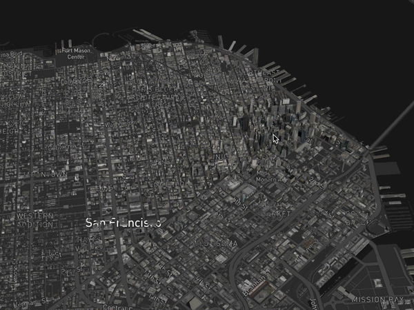
Load I3S tileset and render with deck.gl
A simple react app uses I3SLoader to load San Francisco Buildings, render with deck.gl's Tile3Dlayer and dynamically load/unload tiles based on current viewport and adjust the level of details when zooming in and out.
import React, {Component} from 'react';

import {StaticMap} from 'react-map-gl';
import DeckGL from '@deck.gl/react';
import {MapController} from '@deck.gl/core';
import {Tile3DLayer} from '@deck.gl/geo-layers';
import {I3SLoader} from '@loaders.gl/i3s';

// How to get mapbox token https://docs.mapbox.com/help/how-mapbox-works/access-tokens/
const MAPBOX_TOKEN = ''; // add your Mapbox token here

const INITIAL_VIEW_STATE = {
  longitude: -120,
  latitude: 34,
  height: 600,
  width: 800,
  pitch: 45,
  maxPitch: 85,
  bearing: 0,
  minZoom: 2,
  maxZoom: 30,
  zoom: 14.5
};

export default class App extends Component {
  constructor(props) {
    super(props);
    this.state = {viewState: INITIAL_VIEW_STATE};
  }

  _onTilesetLoad(tileset) {
    // update viewport to the tileset center
    const {zoom, cartographicCenter} = tileset;
    const [longitude, latitude] = cartographicCenter;

    const viewState = {
      ...this.state.viewState,
      zoom: zoom + 2.5,
      longitude,
      latitude
    };

    this.setState({viewState});
  }

  render() {
    const {viewState} = this.state;

    // construct Tile3DLayer to render I3S tileset
    const layer = new Tile3DLayer({
      id: 'tile-3d-layer',
      // Tileset entry point: Indexed 3D layer file url
      data: 'https://tiles.arcgis.com/tiles/z2tnIkrLQ2BRzr6P/arcgis/rest/services/SanFrancisco_Bldgs/SceneServer/layers/0',
      loader: I3SLoader,
      onTilesetLoad: this._onTilesetLoad.bind(this)
    });

    return (
      <DeckGL
        layers={[layer]}
        viewState={viewState}
        controller={{type: MapController}}
        onViewStateChange={({viewState}) => {
          // update viewState when interacting with map
          this.setState({viewState});
        }}
      >
        <StaticMap
          mapStyle={'mapbox://styles/mapbox/dark-v9'}
          mapboxApiAccessToken={MAPBOX_TOKEN}
          preventStyleDiffing
        />
      </DeckGL>
    );
  }
}
A more complex example can be found here, checkout website example.
Basic API Usage
Basic API usage is illustrated in the following snippet. Create a Tileset3D instance, point it a valid tileset URL, set up callbacks, and keep feeding in new camera positions:
import {load} from '@loaders.gl/core';
import {I3SLoader} from '@loaders.gl/i3s';
import {Tileset3D} from '@loaders.gl/tiles';
import {WebMercatorViewport} from '@deck.gl/core';

const tileseturl =
  'https://tiles.arcgis.com/tiles/z2tnIkrLQ2BRzr6P/arcgis/rest/services/SanFrancisco_Bldgs/SceneServer/layers/0';

const tileset = await load(tileseturl, I3SLoader);

const tileset3d = new Tileset3D(tilesetJson, {
  onTileLoad: tile => console.log(tile)
});

// initial viewport
// viewport should be deck.gl WebMercatorViewport instance
const viewport = new WebMercatorViewport({latitude, longitude, zoom, ...})
tileset3d.update(viewport);

// Viewport changes (pan zoom etc)
tileset3d.selectTiles(viewport);

// Visible tiles
const visibleTiles = tileset3d.tiles.filter(tile => tile.selected);

// Note that visibleTiles will likely not immediately include all tiles
// tiles will keep loading and file `onTileLoad` callbacks
Options
| Option | Type | Default | Description |
|---|---|---|---|
options.i3s.isTileset | Bool or auto | auto | Whether to load Tileset (Layer 3D Index) file. If auto, will decide if follow ArcGIS tile layers' url convention |
options.i3s.isTileHeader | Bool or auto | auto | Whether to load TileHeader(node) file. If auto, will decide if follow argis url convention |
options.i3s.loadContent | Bool | true | Whether to load tile content (geometries, texture, etc.). Note: I3S dataset, each tile node has separate urls pointing to tile metadata and its actual tile payload. If loadContent is true, i3s loader will make a request to fetch the content fiile and decoded to the format as specified in Tile Object. |
options.i3s.token | string | null | Authorization token for the layer |
options.i3s.tileset | Object | null | Tileset object loaded by I3SLoader or follow the data format specified in Tileset Object. It is required when loading i3s geometry content |
options.i3s.tile | Object | null | Tile object loaded by I3SLoader or follow the data format Tile Object. It is required when loading i3s geometry content |
options.i3s.useDracoGeometry | Bool | true | Use 'Draco' compressed geometry to show if applicable |
options.i3s.useCompressedTextures | Bool | true | Use "Compressed textures" (_.dds or _.ktx) if available and supported by GPU |
options.i3s.decodeTextures | Bool | true | Decode texture image to ImageBitmap or compressed texture object (if supported by GPU) |
Data formats
Loaded data conforms to the 3D Tiles loader category specification with the following exceptions.
Tileset Object
The following fields are guaranteed. Additionally, the loaded tileset object will contain all the data fetched from the provided url.
| Field | Type | Contents |
|---|---|---|
type | String | Value is i3s. Indicates the returned object is an i3s tileset. |
lodMetricType | String | Root's level of detail (LoD) metric type, which is used to decide if a tile is sufficient for current viewport. Only support maxScreenThreshold for now. Check I3S lodSelection for more details. |
lodMetricValue | Number | Root's level of detail (LoD) metric value. |
Tile Object
The following fields are guaranteed. Additionally, the loaded tile object will contain all the data fetched from the provided url.
| Field | Type | Contents |
|---|---|---|
id | String | Identifier of the tile, unique in a tileset |
refine | String | Refinement type of the tile, currently only support REPLACE |
type | String | Type of the tile, value is mesh (currently only support I3S MeshPyramids |
url | String | The url of this tile. |
contentUrl | String | The url of this tile. |
featureUrl | String | The url of this tile. |
textureUrl | String | The url of this tile. |
boundingVolume | Object | A bounding volume in Cartesian coordinates converted from i3s node's mbs that encloses a tile or its content. Exactly one box, region, or sphere property is required. |
lodMetricType | String | Level of Detail (LoD) metric type, which is used to decide if a tile is sufficient for current viewport. Only support maxScreenThreshold for now. Check I3S lodSelection for more details. |
lodMetricValue | String | Level of Detail (LoD) metric value. |
content | String | The actual payload of the tile or the url point to the actual payload. If option.loadContent is enabled, content will be populated with the loaded value following the Tile Content section |
Tile Content
After content is loaded, the following fields are guaranteed. But different tiles may have different extra content fields.
| Field | Type | Contents |
|---|---|---|
cartesianOrigin | Number[3] | "Center" of tile geometry in WGS84 fixed frame coordinates |
cartographicOrigin | Number[3] | "Origin" in lng/lat (center of tile's bounding volume) |
modelMatrix | Number[16] | Transforms tile geometry positions to fixed frame coordinates |
vertexCount | Number | Transforms tile geometry positions to fixed frame coordinates |
attributes | Object | Each attribute follows luma.gl accessor properties |
texture | Object | Loaded texture by loaders.gl/image |
featureData | Object | Loaded feature data for parsing the geometies (Will be deprecated in 2.x) |
attributes contains following fields
| Field | Type | Contents |
|---|---|---|
attributes.positions | Object | {value, type, size, normalized} |
attributes.normals | Object | {value, type, size, normalized} |
attributes.colors | Object | {value, type, size, normalized} |
attributes.texCoords | Object | {value, type, size, normalized} |